Visibility is not the same as control.
Five questions connecting port queues, lethal force at sea, dual-use activity, strategic infrastructure and ocean warning.
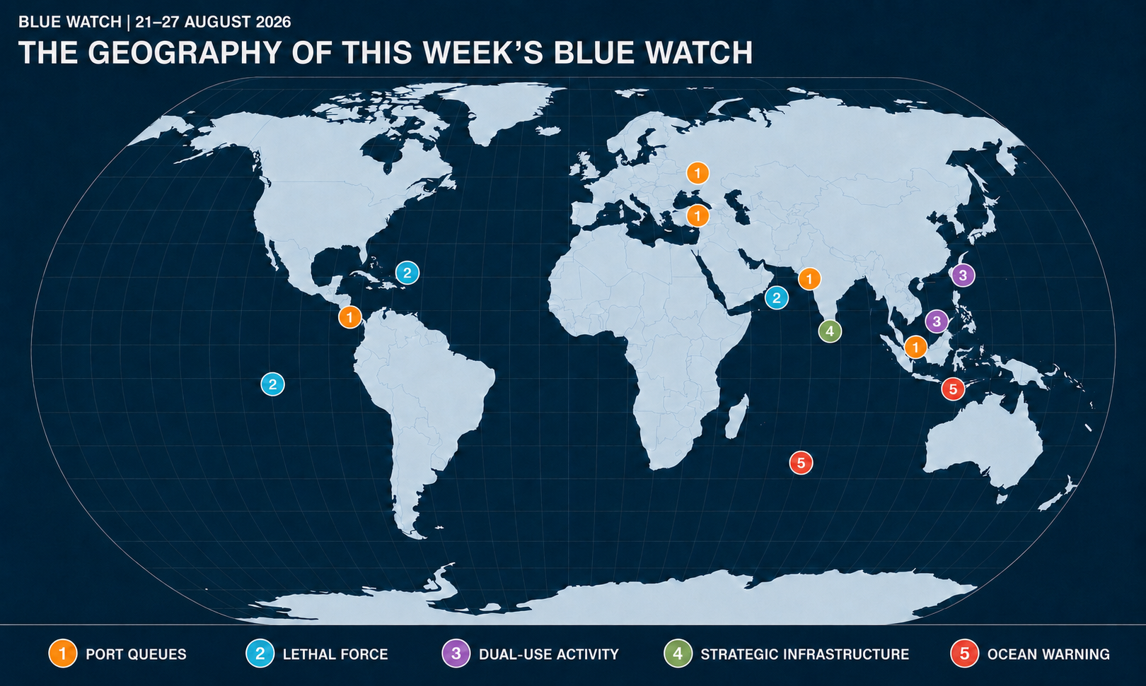
Disclaimer: the map is AI-generated - some dots or routes may not be very precise, but have been retained to show complex links or re-rerouting
1. Queues are where displaced disruption becomes visible
Question:When trade is rerouted, who must absorb the traffic that follows?
The Blue Watch read
Last week’s Blue Watch examined the gatekeepers controlling alternative routes. This week, the consequences are becoming visible in the queues gathering at their edges.
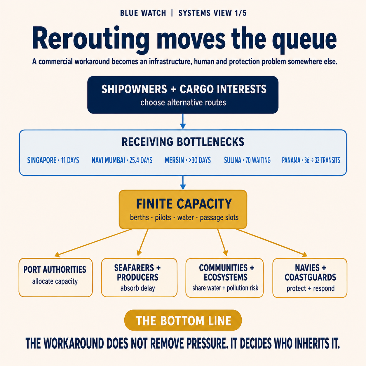
The pressure is not confined to ports nearest the Gulf. Project44 reports that Singapore’s import dwell time has risen to nearly 11 days, its highest level of the crisis. Navi Mumbai reached 25.4 days, while import and transhipment dwell at Mersin exceeded 30 days. Diversions may be declining, but the cargo already displaced through the wider network continues to accumulate.
The same pattern is visible around the Danube. As attacks restrict Ukraine’s principal Black Sea ports, grain has been redirected towards smaller river ports. Up to 70 vessels were waiting near the Sulina Canal this week, where shortages of pilots, fuel prioritisation, air-raid alerts and poor weather have reduced the number of ships able to pass.
Panama adds a different constraint. The Canal Authority will reduce daily transits as below-average rainfall and an intensifying El Niño place renewed pressure on the freshwater system on which the canal and surrounding communities depend.
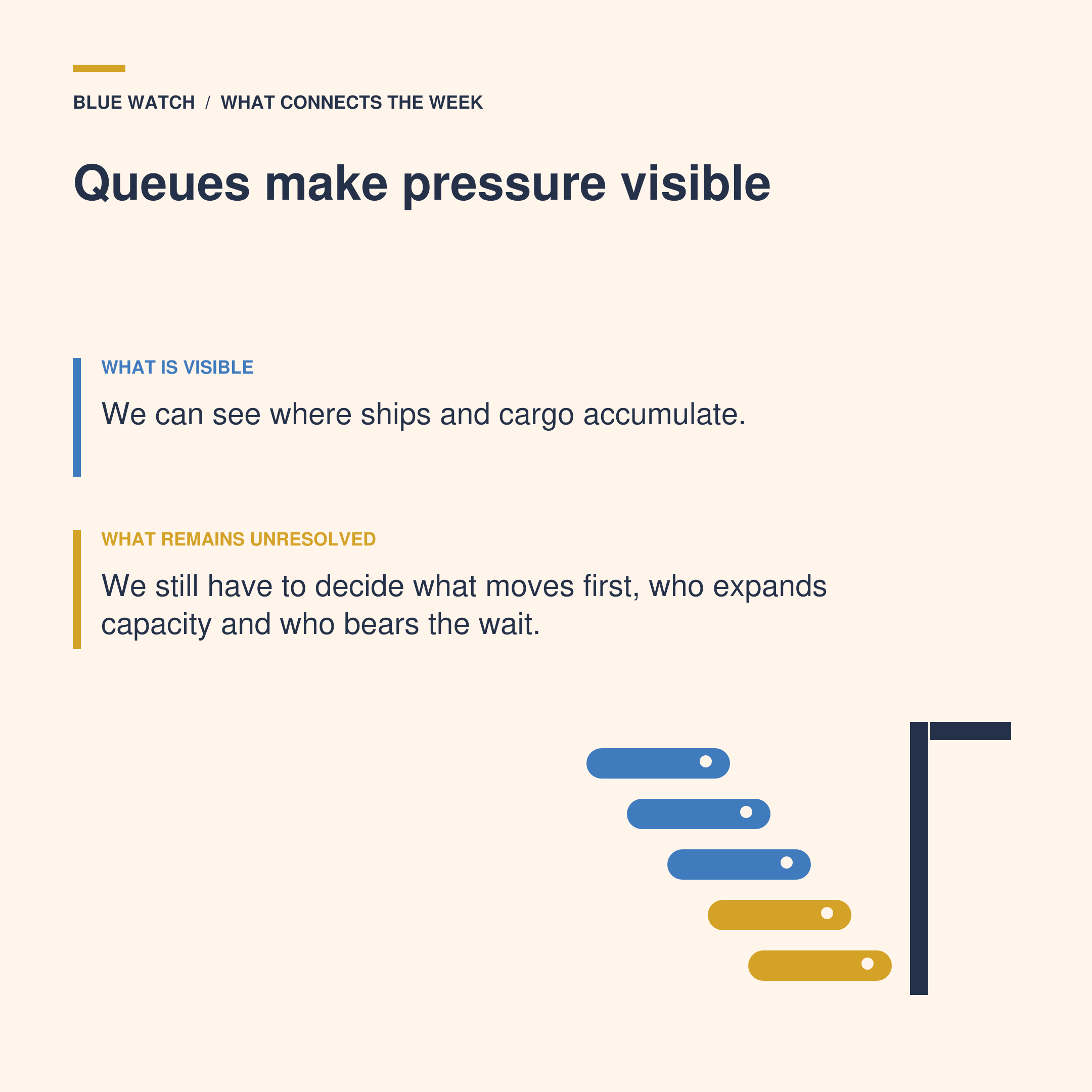
These are not one queue caused by one crisis. They are different physical and institutional limits appearing within the same trading system.
Signals from the week
Singapore recorded its highest import dwell time of the Hormuz crisis, while congestion also intensified at Navi Mumbai and Turkish gateways.
Up to 70 ships were reported waiting near the Sulina Canal, with actual passage reportedly falling to two or three vessels on some days.
The cost of waiting near Sulina may reach thousands of dollars per vessel each day, while delayed grain exports create consequences well beyond the ships themselves.
The Panama Canal will reduce daily transits from 36 to 32 by mid-September after rainfall between May and August fell substantially below average.
The unresolved issue
Rerouting decisions are often made by shipowners, charterers and cargo interests, but the receiving infrastructure is governed by someone else: A commercial operator can select an alternative port but cannot create more pilots, deepen a river, restore rainfall or prevent an air-raid alert; Port authorities can prioritise fuel or essential cargo, but that choice determines which other vessels and communities wait longer. Every workaround therefore contains a second allocation decision at the point where additional traffic meets finite capacity.
Navies and coastguards cannot solve most of these constraints. They cannot shorten terminal dwell in Singapore or refill Gatún Lake. They may nevertheless inherit part of the resulting risk: Congested approaches complicate surveillance and emergency access; ships waiting at anchor remain exposed to collision, crime, attack and pollution incidents; and the concentration of grain or fuel traffic can create attractive targets.
In the Danube and Black Sea, military protection is only one component of passage, and while surveillance and air defence may reduce the threat, they do not replace pilots, navigational capacity, rail connections or functioning terminals. Treating the problem as a purely naval corridor would therefore protect one segment while leaving the wider journey constrained.
The sustainability effects also accumulate quietly. Ships waiting or diverting burn more fuel, crews remain aboard for longer, food exports arrive later and freshwater is allocated between navigation, households and ecosystems. A route that preserves cargo movement by transferring these costs elsewhere is operationally useful - but not necessarily resilient.
2. The decision to use force is the least visible part of maritime security
Question:Who decides when monitoring, interdiction or rescue gives way to lethal force - and on what evidence?
The Blue Watch read
Two different maritime crimes are producing two very different security responses.
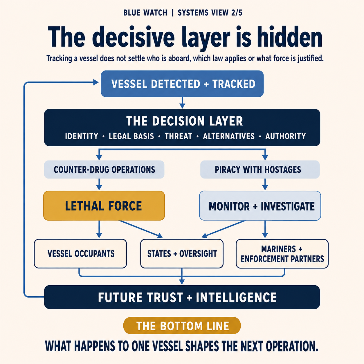
In the Caribbean and eastern Pacific, the United States has resumed lethal strikes against vessels it says are trafficking drugs. This resulted in two people killed in an eastern Pacific strike on 23 August, followed by four in the Caribbean two days later. US Southern Command (USSOCOM) described those aboard as traffickers, but did not publish evidence showing what the vessels carried, how their occupants were identified or why interception was not attempted.
Off Somalia and Yemen, the facts are different. Pirates have seized the Lutuf and Sibu 1, and their crews remain aboard. Operation Atalanta is monitoring and investigating the incidents, but no rescue assault has been publicly announced. That may reflect the immediate danger to hostages, uncertainty over the vessels’ positions and conditions, the need for a viable rescue opportunity or other operational considerations. The absence of an attack should not be mistaken for the absence of action, but the public record does not establish precisely why one option has been chosen over another.
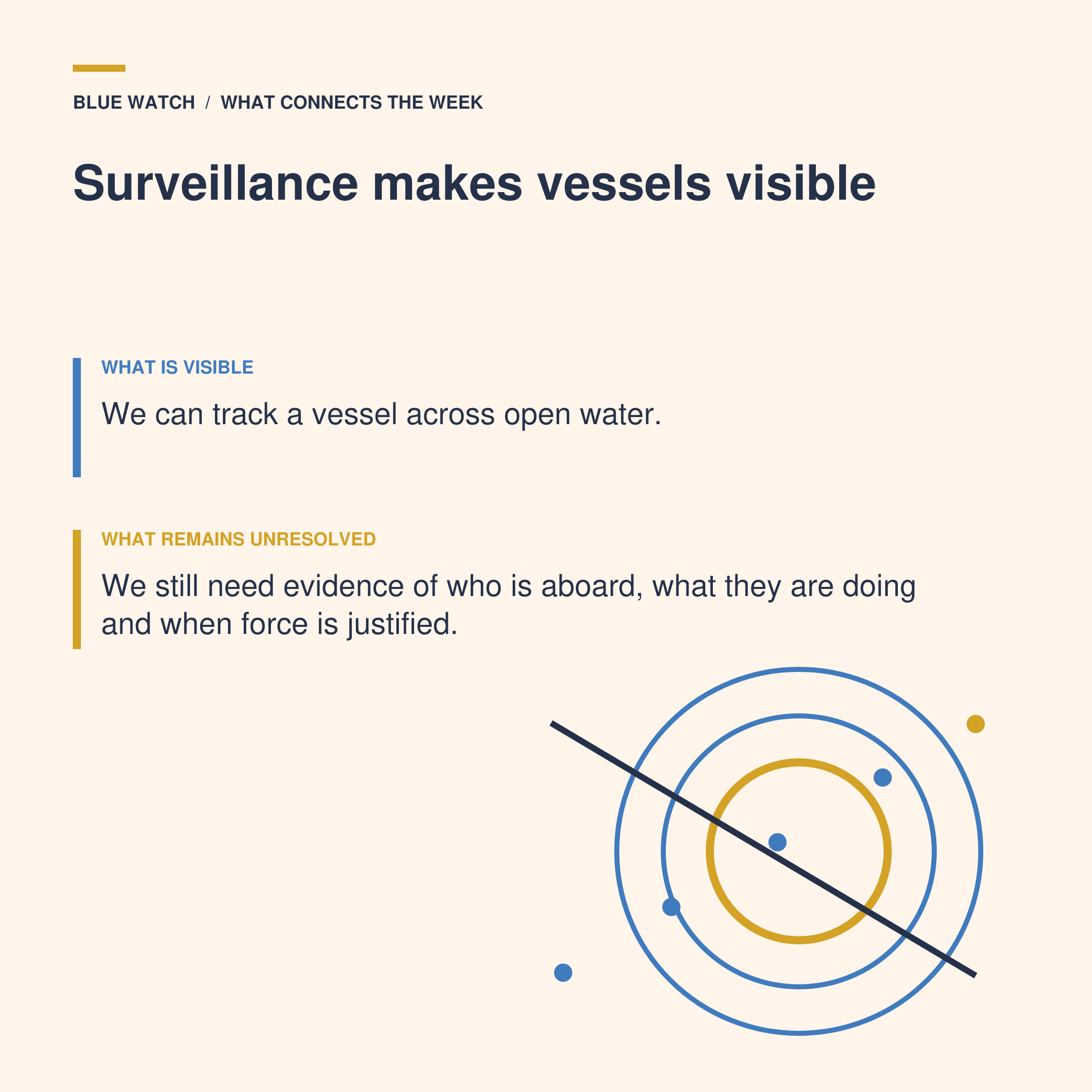
The comparison is not that piracy and drug trafficking should receive identical treatment (they should not). It is that the most consequential decision in both operations - the point at which observation becomes interdiction, or interdiction becomes lethal force - remains largely invisible to those outside the command chain.
Signals from the week
The two latest US strikes killed six people. The campaign has now conducted 68 strikes and killed at least 227 people, according to an Associated Press count.
The US says the vessels operate on known trafficking routes, but has not released public evidence establishing that the people killed in the latest strikes were carrying drugs.
The Sibu 1 was hijacked with 20 crew members aboard, days after the Lutuf was seized with ten crew members and a cargo reportedly including Turkish military equipment.
Operation Atalanta has investigated and monitored the hijacked vessels. NATO’s counter-piracy mission, Operation Ocean Shield, ended in 2016; there is no current NATO counter-piracy operation performing the same role.
The UN human-rights office has maintained that the US boat strikes take place outside an armed conflict and violate international human-rights law. Washington argues that it is engaged in an armed conflict with designated cartels.
The unresolved issue
Calling a campaign a “war on drugs” does not by itself answer which body of law governs a particular strike. At sea, jurisdiction, the right to visit a vessel and the authority to board are distinct from the decision to use lethal force. Outside an armed conflict, the starting point is a law-enforcement model in which arrest and due process matter, and intentional lethal force is exceptional.
The deeper operational question is how the people aboard a vessel are classified before force is used. Are they identified as suspects, coerced crew, hostages, civilians directly participating in violence or military targets (see last week’s Blue Watch)? What intelligence is required? Who tests its reliability? What threat must be present? Which non-lethal alternatives were considered, and who reviews the decision afterwards?
Navies already possess procedures for target validation, command authorisation, legal advice, proportionality, rescue and battle-damage assessment. Counter-narcotics operations also have a long history of detection, interception, boarding, evidence preservation and prosecution. Moving directly from surveillance to destruction changes not only the weapon used, but the purpose and accountability chain of the mission.
Somali piracy demonstrates why restraint may itself be an operational act. Once pirates and hostages occupy the same vessel, a technically successful strike could kill the people the mission is intended to protect. Yet restraint also has costs: crews remain captive, criminal networks may recover ransom and other ships remain exposed. The decision cannot be reduced to “attack” or “do nothing”.
While, understandably, some intelligence must remain secret to preserve sources and future operations, it does not remove the need for a publicly intelligible doctrine. A security campaign that does not explain its legal basis, evidentiary threshold or review process risks weakening trust among coastal states, fishing communities and mariners whose cooperation is essential to identifying genuine criminal activity.
3. Research and construction can shape the military environment before intent is clear
Question: How should states respond to activity that may support military operations without treating suspicion as proof?
The Blue Watch read
Taiwan’s coastguard again shadowed and warned the Chinese research vessel Tongji as it sailed through sensitive waters west of the island. It was the ship’s third appearance since May.
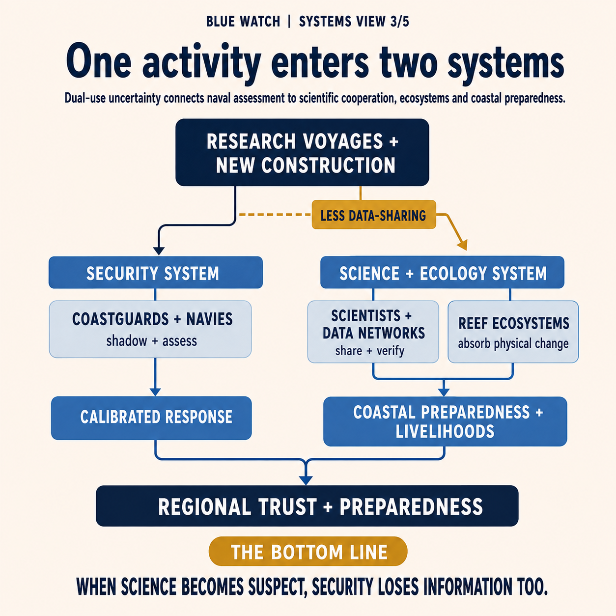
The latest transit illustrates the difficulty of dual-use activity. While Taiwanese authorities did not observe the vessel deploying or towing instruments during this passage, the Tongji is nevertheless equipped with laboratories, remotely operated vehicles and unmanned systems capable of gathering information with both scientific and strategic value.
Bathymetry, temperature, salinity, currents and background noise all matter to legitimate ocean research. They also affect sonar performance, submarine operations, mine warfare, unmanned underwater navigation and the protection or targeting of seabed infrastructure. The data do not become military simply because a navy could use them; nor does a civilian label prevent them from shaping the military operating environment.
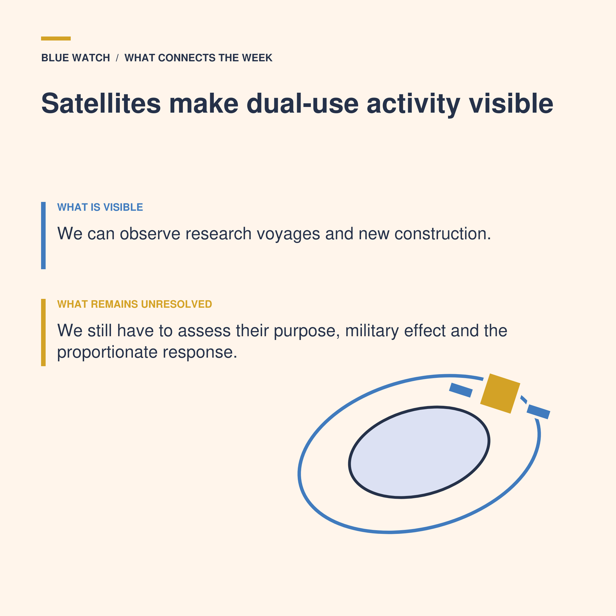
Nearby, commercial satellite imagery revealed new installations on Yagong Island, close to China’s expanding construction at Antelope Reef. Analysts believe the structures may eventually support early-warning radar, but their purpose has not been confirmed. Here again, visibility enables an assessment without settling it.
Signals from the week
Taiwan said it had warned off and shadowed the Tongji after detecting it near Penghu and Liuqiu.
The vessel was not observed using survey equipment during this transit, although Taiwan has accused it of conducting unauthorised activity during previous appearances.
New structures appeared on Yagong Island near Antelope Reef. Their function remains uncertain, although they resemble radar or early-warning facilities elsewhere in the South China Sea.
Taiwan’s parliament rejected the government’s proposed special drone budget but approved an alternative six-year funding plan. The dispute now concerns the timing, control and annual profile of spending as much as the principle of acquiring drones.
The unresolved issue
China can describe research, weather monitoring and construction as civilian while retaining the option to use the resulting data and infrastructure for military purposes. Taiwan can treat repeated activity as strategically significant without possessing public proof that every voyage or installation has a military task.
This places coastguards and navies in a difficult position. If they ignore ostensibly civilian activity, they may allow another state to improve its operational knowledge and permanent presence. If they respond as though military intent has already been established, they risk escalating routine navigation or research and weakening the distinction between evidence and suspicion.
While more surveillance is undoubtedly part of the answer, better evidence management also matters: recording routes and instrument use, comparing data over time, distinguishing observation from interference and deciding which agency should respond. Coastguard shadowing may be more proportionate than a naval confrontation, while naval and hydrographic specialists can assess what information is being gathered and why it matters.
There is also an environmental cost. Artificial-island construction can permanently alter reefs and sediment systems, while the increasing securitisation of research activity may make states less willing to share ocean data needed for climate, fisheries and disaster planning. Strategic competition can therefore degrade both ecosystems and the scientific cooperation required to understand them.
4. A strategic port can become a battlefield before it receives a ship
Question: Who bears the security cost of infrastructure justified as regional resilience?
The Blue Watch read
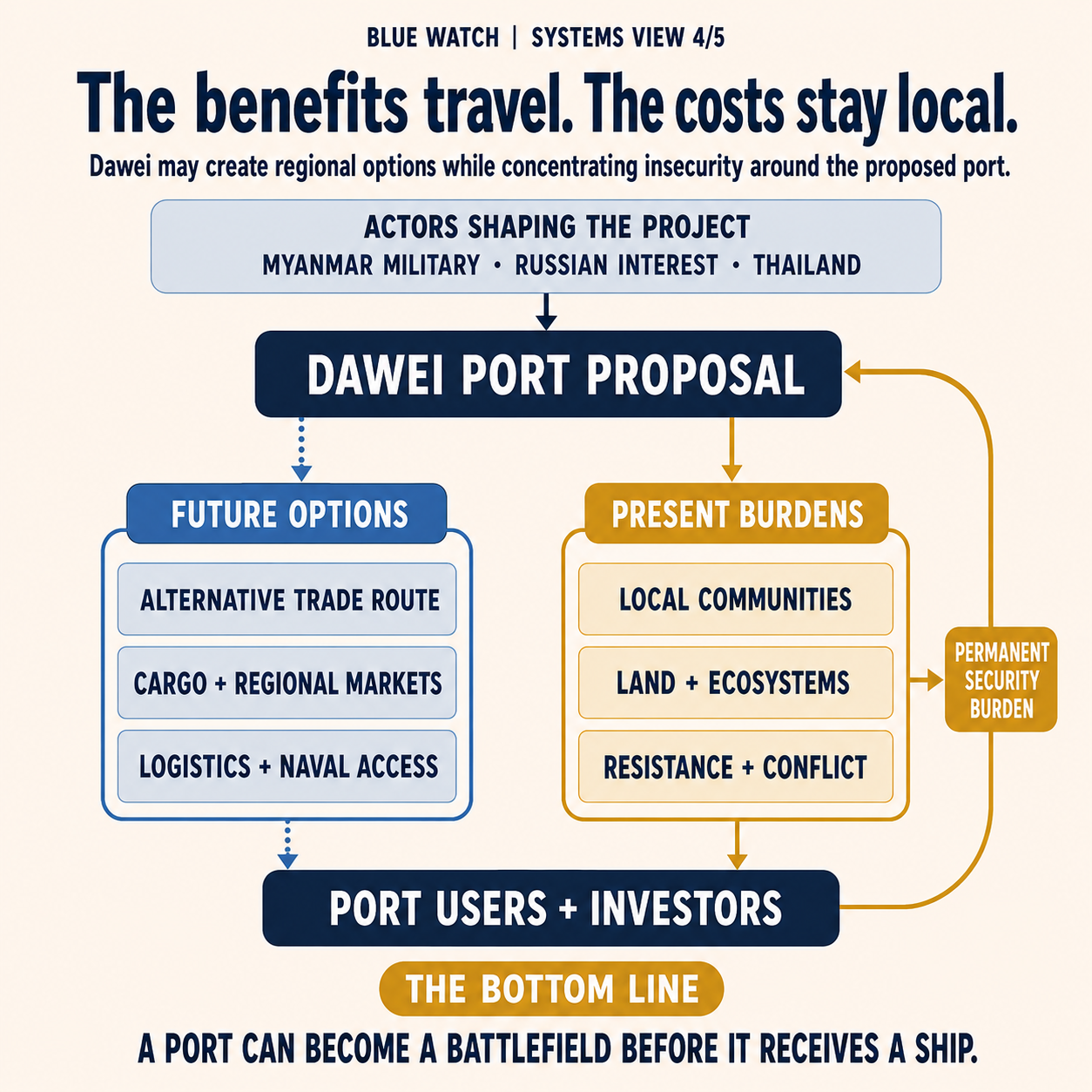
Myanmar’s military has deployed hundreds of troops around land intended for the long-delayed Dawei Special Economic Zone. Local sources describe villages being burned, residents displaced and resistance fighters pushed back from territory surrounding the proposed deep-sea port and power plant.
The project is presented as a new route between the Andaman Sea and mainland Southeast Asia, reducing dependence on the Strait of Malacca if the necessary port, road and cross-border infrastructure can be completed. Myanmar is seeking Russian support to revive it after earlier plans stalled.
It would be premature to say that Russia is building a port or establishing a naval base at Dawei, as investment remains under discussion and the final commercial, security and access arrangements have not been disclosed. The military operation nevertheless shows that the project is already altering security on the ground.
The port does not need to exist to influence deployments, displacement and regional calculations.
Signals from the week
Reuters reported that the Myanmar military had launched an offensive around the Russia-backed Dawei project, using hundreds of troops and sealing off surrounding areas.
The proposed zone includes a deep-sea port and power plant on the Andaman Sea, with planned overland connections to Thailand and wider regional markets.
According to local activists and resistance figures, the offensive has been reinforced by air and naval attacks, although the precise relationship between individual operations and the port project remains difficult to verify independently.
The unresolved issue
Strategic-port analysis often begins with the finished infrastructure: draught, berths, cargo capacity, road connections and the foreign vessels that might eventually call there.
But Dawei requires the analysis to begin earlier. Who owned and used the land? How were communities consulted? Can environmental and social assessments be credible during an armed conflict? Who provides security, and against whom? If the port is built through coercive displacement, the resistance around it may become a permanent protection requirement rather than a temporary construction problem.
For Russia, Dawei could offer commercial access to the eastern Indian Ocean, opportunities for energy and industrial cooperation and a stronger relationship with a government already dependent on Russian arms and diplomatic support. Future logistics or naval access is a possibility worth watching, not an established fact.
For regional navies, the significance lies in the options the port could create. A functioning deep-sea facility on the Andaman Sea could affect surveillance, replenishment and access calculations involving India, Thailand and the Malacca approaches. It could also generate demands for port security, maritime-domain awareness and protection of shipping linked to a conflict-affected hinterland.
The Defending Blue question is more fundamental: Infrastructure cannot be called resilient solely because it creates an alternative route; its legitimacy, environmental effects, financing, maintenance and relationship with surrounding communities determine whether it can operate without reproducing the insecurity it was meant to solve.
5. Warning is improving faster than preparedness
Question: Can ocean intelligence change decisions before the next emergency?
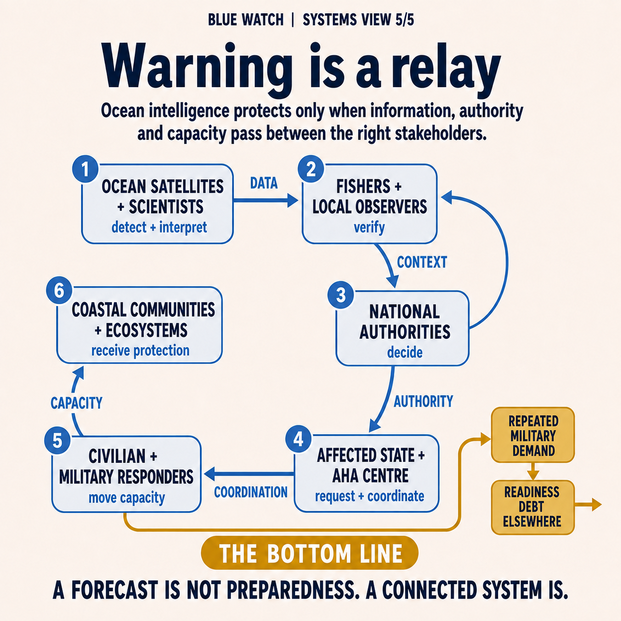
The Blue Watch read
The global average sea-surface temperature reached 21.1°C on 22 August, the highest daily value in the available record. The immediate increase is being amplified by El Niño, but it sits on top of long-term human-driven ocean warming.
Warmer water can intensify marine heatwaves, reduce oxygen, damage coral and alter the distribution and productivity of marine species. It also provides more energy to weather systems, although no individual storm should be attributed to a global temperature record without a specific scientific assessment.
At the base of the marine food web, scientists are improving the use of ocean-colour satellites to estimate chlorophyll and changes in phytoplankton. This greatly expands the area that can be monitored, but different products can still produce different estimates: while a satellite can identify an anomaly, it cannot by itself explain the ecological process beneath it or determine how fisheries and coastal authorities should respond.
Southeast Asia provides a practical test of how better warning becomes action. The region already has a regional disaster-cooperation architecture. The AHA Centre supports monitoring, ASEAN emergency assessment teams, common procedures and pre-positioned relief supplies. It is not, however, a standing supranational response force. Assistance generally depends on the request or acceptance of the affected state, and national capacity remains decisive.
Signals from the week
Global average sea-surface temperature reached a record 21.1°C, increasing pressure on marine ecosystems, fisheries and coastal communities.
A new assessment highlighted how ocean-colour satellites are improving estimates of phytoplankton, while also showing that the choice of data product affects the trend detected.
The AHA Centre monitors hazards and mobilises regional tools including ASEAN-ERAT and the DELSA relief-stockpile system.
An affected ASEAN member state can request assessment teams, relief items or assistance from other members through the AHA Centre. Military support can also be coordinated when it is requested or accepted.
The unresolved issue
Early warning is valuable only if it changes what happens before impact.
For coastal states, that means linking ocean and weather data to decisions over fishing access, public-health warnings, evacuation routes, port closures, relief stockpiles and the protection of power, water and communications. It also means recognising uncertainty without using it as a reason to delay every preparatory measure.
Navies and coastguards are central to this system, but they cannot be its permanent reserve capacity. They provide ships, aircraft, hydrographic knowledge, communications, medical support, logistics and command structures that are difficult to assemble during a crisis. Repeated Humanitarian Assistance/Disaster Relief (HA/DR) deployments nevertheless consume fuel, flying hours, maintenance, crew endurance and training time needed for other missions.
A sustainable model therefore combines military lift and coordination with civilian ports, local vessels, health services, relief organisations and communities. Regional arrangements should make those relationships usable before a disaster, not simply provide a diplomatic framework through which assistance can be offered afterwards.
The same applies to ecological warning. Satellite coverage should be connected to sampling, catch records and local observation. Better ocean colour cannot replace water testing, species monitoring or the knowledge of fishers who see changes in timing, location and catch composition. Visibility becomes protection only when different forms of evidence reach an authority able to act.
What connects the week
This week’s stories share an apparent success: maritime activity is increasingly difficult to hide. Yet greater visibility does not settle the decisions that follow.